Pinehaven and Silverstream missing from Consultation. Your submission can put them back in
Ask Council to include Pinehaven and Silverstream, and extend this information-poor flood mapping consultation.
Why Pinehaven Flood Maps Must Be Included in Upper Hutt flood mapping consultation
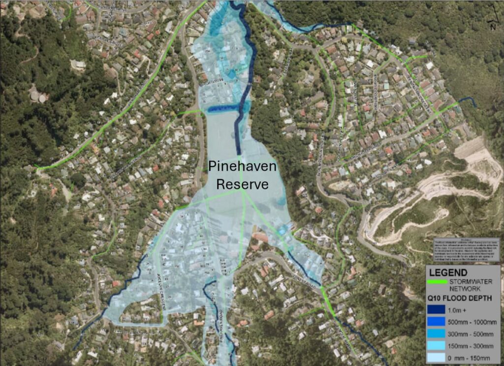
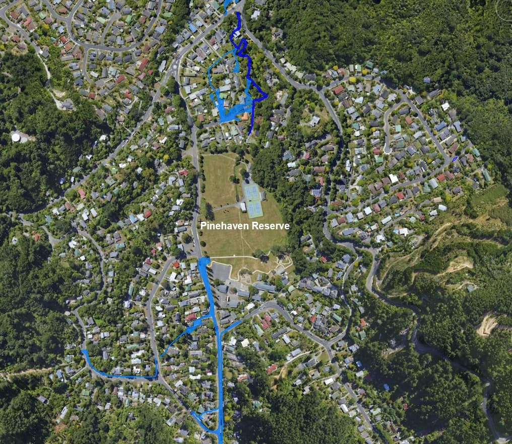
The Pinehaven and Silverstream flood maps are among the most outdated and disputed in Upper Hutt, built from a flawed 2010 model that was never properly checked and consistently fails to match what residents have observed on the ground. These flood maps exaggerate flood extents, mislabel safe properties as flood prone, and conceal the real impacts of future development on the Pinehaven and Silverstream hills. Excluding them from a city-wide flood-map review undermines public trust and risks locking in costly planning mistakes for years to come. Pinehaven and Silverstream residents deserve accurate, evidence-based flood maps, and this consultation must include them.
Why the Consultation Must Be Extended and Provide Better Information
The current Upper Hutt flood mapping consultation is supported with too little information for residents to make informed submissions. It runs immediately after local elections, before Councillors are fully briefed or available, and without the essential technical information needed to understand how the maps were produced. Even basic questions are being treated as LGOIMA requests with responses delayed until well after the consultation closes. With weak flood model calibration, and no information showing the public how the flood models match past floods, the process falls well short of genuine and informed community engagement. An extension is essential for fairness, transparency, and credible flood mapping.
Common Misconceptions About the Pinehaven Stream Flood Maps
Many people assume the Pinehaven flood maps are reliable because they are “completed,” “audited,” “operative” or “already reviewed”, but these assumptions are not supported by the evidence. The current maps contain significant errors, were calibrated to a mis-calculated flood, and fail to match the real floods of 1976, 2009 and 2019. Key errors were never disclosed during past consultations, leaving the community unaware of mistakes that now affect property rights, planning decisions, and local safety. Our ‘Common Misconceptions’ page explains these issues clearly and shows why Pinehaven must be included in the current flood-map review.